For the best description, visit the map site I've set up on Google Maps: Click Here
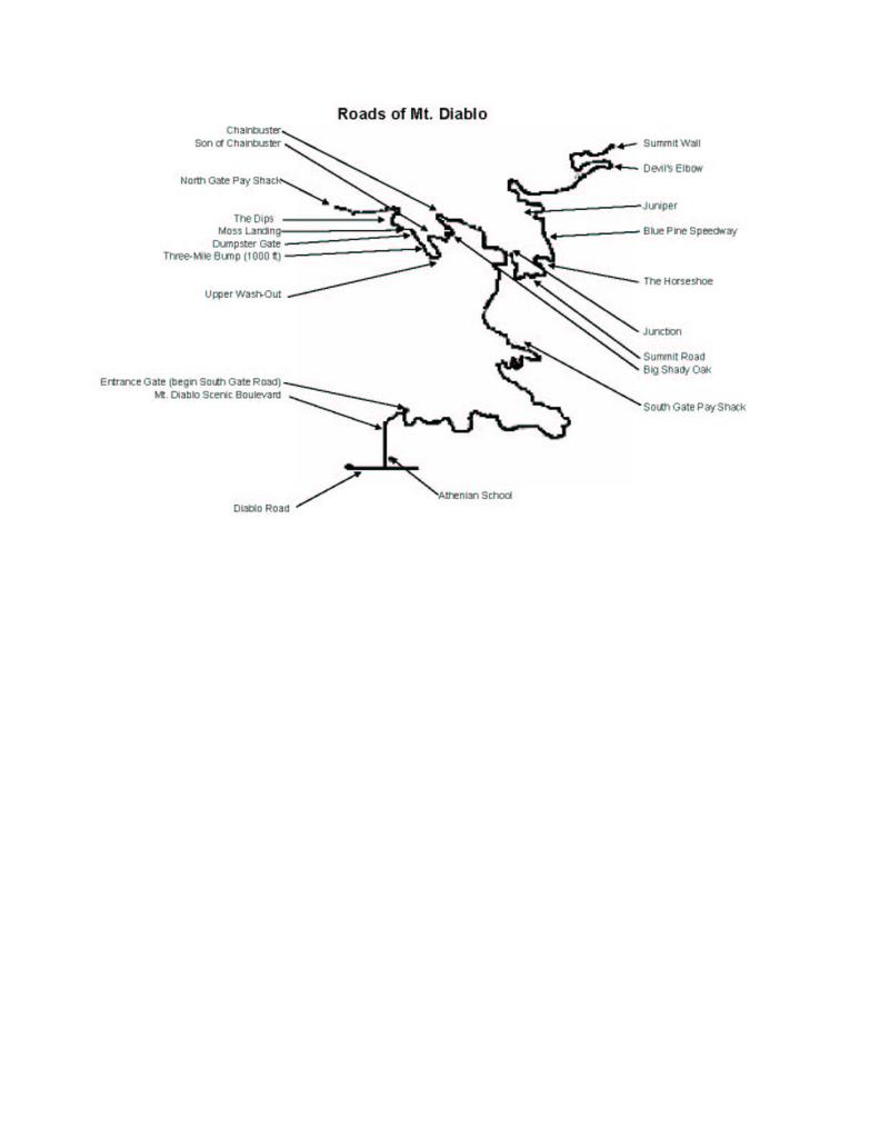
Almost all my rides are up North Gate Road so that side has the most location names. Starting from the bottom we have:
The Church Actually about a mile and a half below the start, just a couple blocks up North Gate Road from Castle Rock Road. It's where a lot of people park and where the Diablo Cyclists meet up for their rides. It's a Mormon church and there's parking on Doncaster, the cross street.
The Gate Mile 0.0, also known as North Gate Kiosk. This is where we always meet up. Some folks drive and park at the Church or elsewhere and we'll meet up before here, but this is the official meeting place and the location to start timing your ride from. The park is open until dusk and then they close the incoming gate. They put in the tire poppers about year 2000 to keep people from sneaking in the exit during the time the incoming gate is closed but the exit gate is still open to let people out. There's not always a ranger on duty here.
The Dips
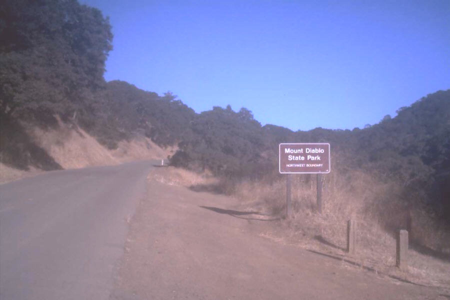
Dumpster Gate / Boundary Gate Years ago there was barbed wire fence on both sides of the road here (and most of the mountain) and there was a gate where those traffic blocker posts are now. This is the access point to some MTB and hiking trails down to Little Pine Creek. There was a dumpster where that photo sign is now. The fence, the gate and the dumpster have been gone for a long time but the location nickname remains.

Lower Washout On the climb, about two miles from the Gate, at the end of the long mostly straight section, just a little past the Dumpster Gate and just before you make a sweeping left turn and start the curvey section below the Bump. One winter after some heavy rains the right side of the road (in the uphill direction) got washed out and they coned it off to single lane and put stop signs on both sides. There was plenty of room for bikes to go up on the right, but cars would have to go in the left lane to get by - so you had to be careful on the way down because there might be a car in your lane. This is right at the point where you can really let loose and get some great speed so it was a pain to have to slow down. It was washed out for about three years before they fixed it... about the same time they fixed the Upper Washout.
Moss Landing Moss Landing is where my old buddy "Moss" crashed on the descent. It's essentially the same place as the Lower Washout but on the other side of the road. As described above, this is where you can really develop some speed. On the fateful day (a Wednesday after work ride), Moss was ahead of me coming around the sweeping turn. Suddenly he seemed to loose his concentration and he drifted off the pavement to the right. That slowed him down some and I knew he was in trouble so I started to slow down also. He didn't panic, but in trying not to crash he wound up riding UP the grade to the outside and finally his wheel sunk into something and he flipped over the bars. It was a glorious crash. Luckily I had parked my car down below so I went to get it and then brought him to the ER where the doctor scrubbed his hide really good. He was on crutches for a couple weeks but otherwise OK.
Rib Rattler At 2.5 miles from the Gate is a non-descript, shaded left hand turn a couple hairpins below the Bump. A few years ago JB had taken off work a little early to get a partial ride in and on the way down he ran over a snake here and crashed. His ribs weren't broken but the injury was bad enough to slow him down for a long time and give the place a cute name. Other than that nothing has ever happened here. Also he did a little damage to his bike and I think he needed a new fork from Mr. Della Santa. 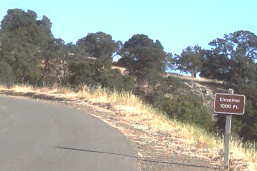
The Bump At 3 miles from The Gate there's a section of 10% grade that we sarcastically call The Bump - it's the hardest part of North Gate Road. You make a right turn and then it gets tough and you follow the road around to the left where you'll see the 1,000 foot elevation sign. About half way up you'll see where Burma Road (dirt trail) crosses and there's a photo sign down to the right. Then it gets just a smidge easier but still about 7% all the way to the Upper Washout.

The Upper Washout / 3mtg This section washed out the same year as the Lower Washout and for quite a while it was single lane with stop signs on both ends. Now there's a sort of retaining wall on the downhill side with a little curb to get rainwater to run away from the section that slides. When you get to the end of the retaining wall you're at mile 3.55 and have two miles to the Junction. I like to take a split time here - it's usually very close to half of my Junction time.
The Cold Shoulder Beyond the Upper Washout is a little section of almost no slope. It's a place either to recuperate or accelerate. Then there's a right hand turn under some shady trees with a pull-out off to the left - that's the cold shoulder. Nothing ever happens here either but somehow it got this name.
Lower Ranch / Diablo Ranch
Clavicle Cracker
2mtg
Upper Ranch / Turtle Rock Ranch The sign is gone now, but the big white log frame over the driveway is still there. I think it used to be a place that groups could reserve for picnics and camp outs but I'm not sure what they do now... maybe it's private. Used to smell a lot of barbeques here in the mornings.
Son of Chainbuster
Big Shady Oak / 1mtg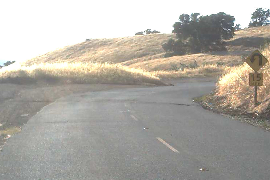 Chainbuster This comes at about 5.7 miles from the Gate, it's the last steep, sharp right hairpin turn before that long semi-straight section to the Junction. Many years ago, it may have been my first year riding Diablo, I came around this corner standing up in a big gear and my chain snapped. It must have broken at the freewheel end because my pedal went down fast which sort of sling shotted the chain forward; all my weight was over the front wheel so I sort of did a reverse wheelie and I remember looking down at the pavement and seeing my chain skid across the pavement underneath me. One of the only crashes I've ever had on the mountain was going up... nothing serious, I just kind of fell over. I managed to ride most of the way back down without a chain but did have to walk up the dips. Anyway, Chainbuster was the first "feature" of the Mountain to get a nickname. I always think that the sign there looks like a broken chain; the photo here is taken from above Chainbuster, as you'd see it on the descent.
Ranger House A quarter mile below the Junction is a house with a garage where some of the rangers who live in the park stay. There's a water fountain here but you're almost at the Junction so not many people stop. There are other ranger houses on the Mountain, but this is the only one on North Gate.
The Junction South Gate Road and North Gate Road meet at the Junction and Summit Road goes up from there. There's a ranger shack that's usually occupied with someone to answer questions and take day use fees. There's water, restrooms, bike racks, some benches built by an eagle scout. Most folks stop here at least for a bit. Once we get here we decide if we're going to go up, down, or back around. It's a good place to regroup and have a chin wag with other riders. Camping and picnic facilities are also available.
Starting at the bottom of South Gate Road:
The Athenian School This is where the Diablo Challenge starts and some people like to time themselves from here. There's usually parking but if a soccer game is happening there won't be.
The Hole in the Fence a short cut to Danville through mansionville that bypasses some of the hairy stuff on Diablo Road.
The Tire Poppers (Park boundary, Mt. Diablo Scenic Blvd becomes South Gate Road here) A gate here can block incoming traffic in case the park's closed for fire danger or something, the tire poppers prevent cars from going around the gate. This is where I always time myself from when I ride South Gate Road.
The South Gate Kiosk
Rock City
Helicopter Pad
Stagecoach
The Junction (see above)
And starting from the Junction and going up Summit Road
Livermore Valley Scenic Overlook
The Horseshoe
El Toyon
Blue Oak Speedway
Anti-Gravity Corner
Juniper Two miles beyond the Junction is Juniper Campground. There's a big parking area with great views of the East Bay; you can see Mount Tamalpais, Mount Hamilton, Oakland, San Francisco, and sometimes the Farallons. Bathrooms and water are available and there are access points to MTB and hiking trails too. Juniper is an intermediate stop on your way to the Summit and can be a good turn around point if you don't have time to go any higher.
Devil's Elbow This is actually a real geographical feature - I think it's even registered with USGS. At about a mile below the Summit it's a sharp uphill left turn hairpin - very much like Chainbuster but the opposite direction. You'll see a trail off to the right too. Once past here you get a little bit of a decrease in the grade until you get to the Lower Parking Lot.
Lower Parking Lot Most cyclists skip this spot but if you turn right just before you get to the Summit Wall you can ride quite a ways to the east and get some great views that are different from the Upper Parking Lot. There's also a great view of the Summit Wall and you can watch riders struggling up. There are also restrooms and water and picnic tables down here and a bunch of really big antennas. The Lower Lot is where the space ships will land when the aliens come.
Summit Wall The Diablo Cyclists and maybe some other folks call this "The Ramp". It's the one-way (up) section of road between the Lower Parking Lot and the Upper Parking Lot. It's 275 meters of 17% average grade and it's kind of narrow so make sure there are no cars behind you when you start up. After you've climbed 11 miles this is the final leg-breaking little stretch that will max out your heart rate. There's a barrier they can use to close it off if it's frozen and I always start counting my pedal revolutions there (actually I count half-revolutions, so every "step") and it's 180 half-revolutions in my 39x27 gear from the barrier to the top. It's so steep that I don't want to look up so I just concentrate on counting and when I get to 180 I'm there. There's another one-way section to come back down and it's not quite as steep; they use the "down" section to go up during the Diablo Challenge because they make everybody go back to the Lower Parking Lot - if they didn't do it this way, the riders going up would have to cross paths with the riders coming back down.
Upper Parking Lot The end of the ride. There's a visitor center and restrooms and water and benches. This is where most of the car day trippers come for the views. From up here you can see 50 miles in every direction if the skies are clear; it's the trophy for a good ride.